II Jornades Cartografies Col·laboratives
19th October 2019. Centre Cultural Albareda. Barcelona.
Collaborative Mapping:
Maps for/by citizenship
Carlos Cámara Menoyo
‘Mapeado Colaborativo’
carloscamara.es | @carlescamara
Carlos Cámara Menoyo
Mapeado Colaborativo’s cofounder. Researching about commodifications between city, technology and society.
So far, I have focused on the topic of social and spatial inequities to find ways in which cities can be more sustainable and egalitarian, hence improving people’s well-being.
https://carloscamara.es | @carlescamara
About “Mapeado Colaborativo”
Aimed to promote (collaborative) cartographies and empower citizenship to create their own cartographies, through action-research projects.
What do we do?
- Workshop and fortnightly sessions
- Talks (complete list here)
- Projects
Projects
Led by us
OpenStreetMap Handbook
Introductory collaborative handbook to OSM (still ongoing). Part of our process of documenting what we do.
‘Ziclabilidad’
Dynamic Map of bicycles' infrastructure in Zaragoza:
- Bicycle lanes and ciclable ways: type, paving, smoothness…
- Public bicycle rental stations (BiZi): name, address, picture, number of free spaces
- Bicycle rack
- Bicycle shops
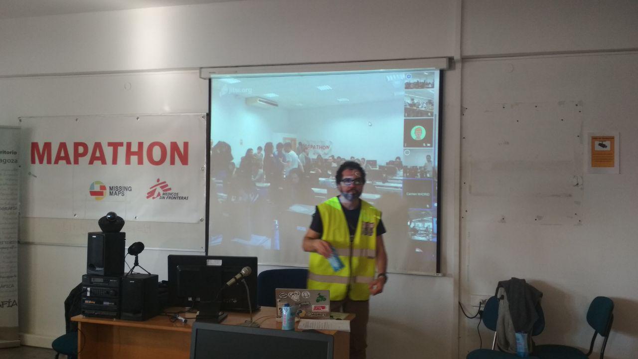
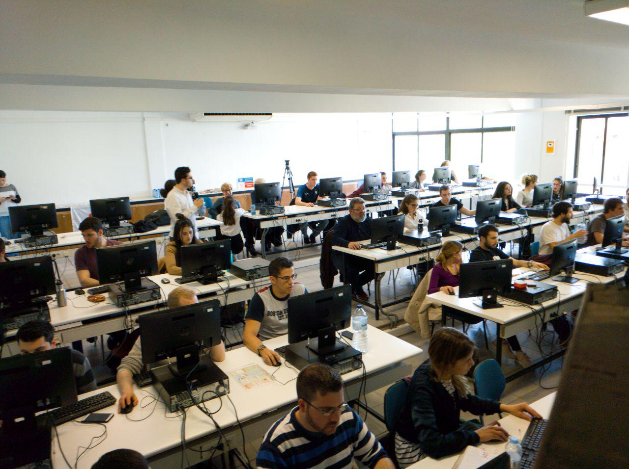
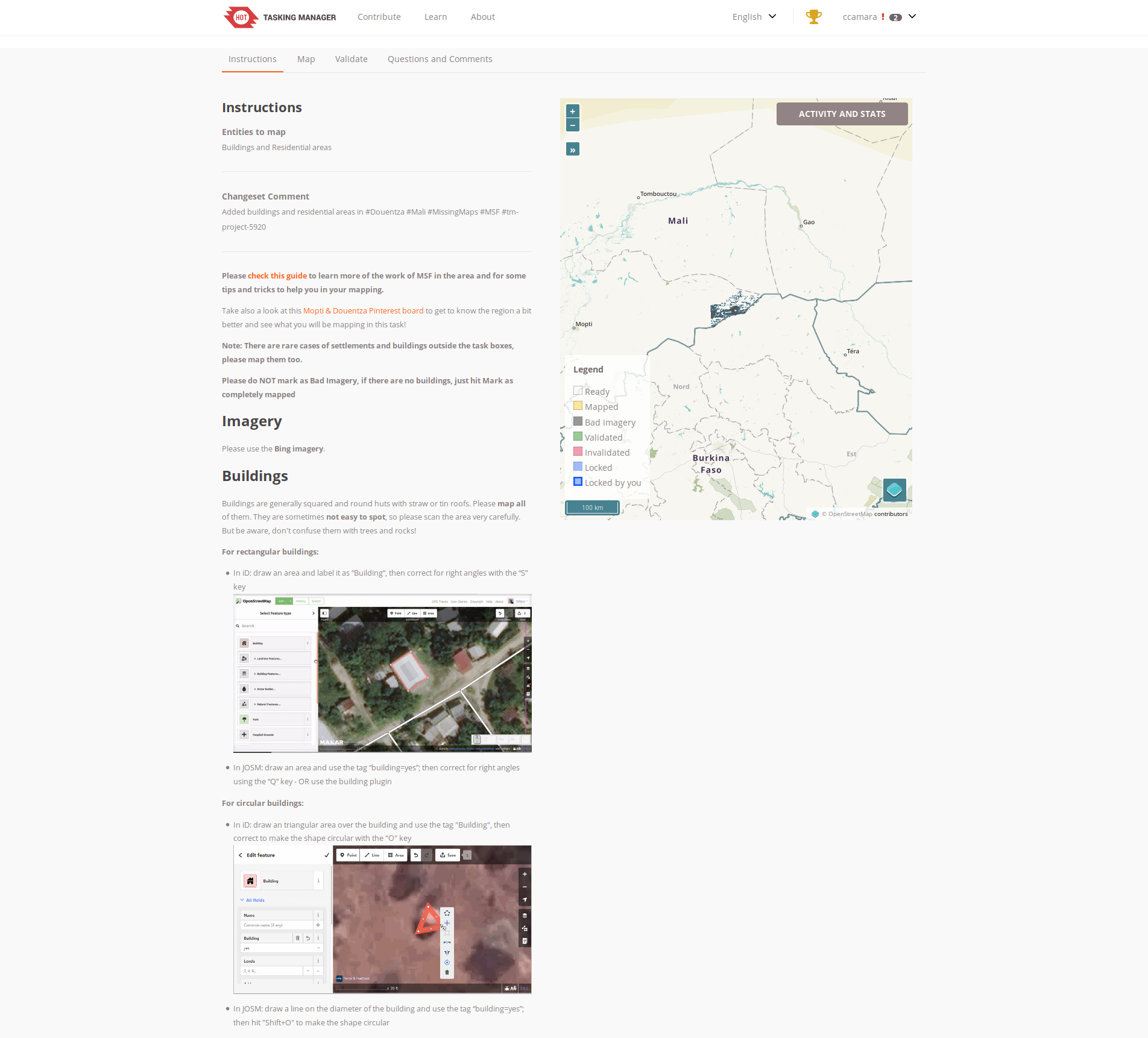
Humanitarian Mapathon
There are still places in the world that have not yet been mapped. Normally that’s not all they’re missing.
We collaborate with MSF to map the areas where they are working in order to make their job easier.
About ‘Accessible Zaragoza’
A barriers' map for a city without them
(Part 1)
Our Goal
- Improve disabled people’s autonomy through the creation of a pilot to overcome those 2 problems:
- Assessing Zaragoza in terms of accessibility
- Providing routing calculations for disabled people in order to improve their autonomy
- Test a protocol/methodology
Some figures about disabilities in Spain <span class=‘fragment '
from 2008!!!
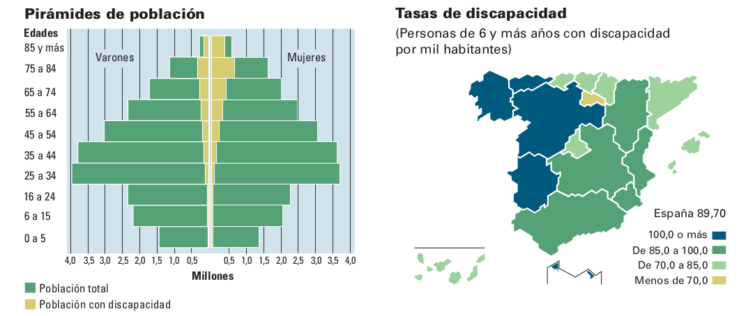
Source: INE. (2009). Encuesta de Discapacidad, Autonomía personal y situaciones de Dependencia. 2008. Recuperado a partir de https://www.ine.es/revistas/cifraine/1009.pdf
Accessibility maps do not exist*!
(Nor the number of people with disabilities in Spain)
Why is so?
- Because it is expensive to gather data (and keep it updated)
- Because it is complex
- Because there is no clear business model behind
- Because they do not respond to a pattern of "normality"
- ...
…and yet…
It would be extremely useful if data like that existed!
- They would considerably improve many people’s autonomy.
- They would show problems of current cities.
- They would be able to change public policies and city models.
We can all make maps!
VGI: Crowdsorcing applyed to maps
From web 2.0 to VGI:
- Collaborative apps
- FLOSS
- Cheaper technology
- Global Positioning Technologies (GPS, Galileo…)
- Free Licenses
- OpenData
OpenStreetMap
AKA “The wikipedia of the maps”
- Collaborative approach (data gathering and storage)
- Data Sharing (legally + technically): social return
OSM is the biggest and most precise spatial free database of the world
Although, in fact…
There are plenty of maps
Collaborative spatial database
Worldwide community
- ~5.4 millions of registered users
- (~ 100 editing daily in Spain)
- ~ 4.500 milion nodes
- (20.000 - 30.000 created every day in Spain)
- Data under Open Database License (ODbL)
Source: osmstats.neis-one.org
Applications and services
Accessible Zaragoza
Part 2
Type of data
What kind of data do we gather?
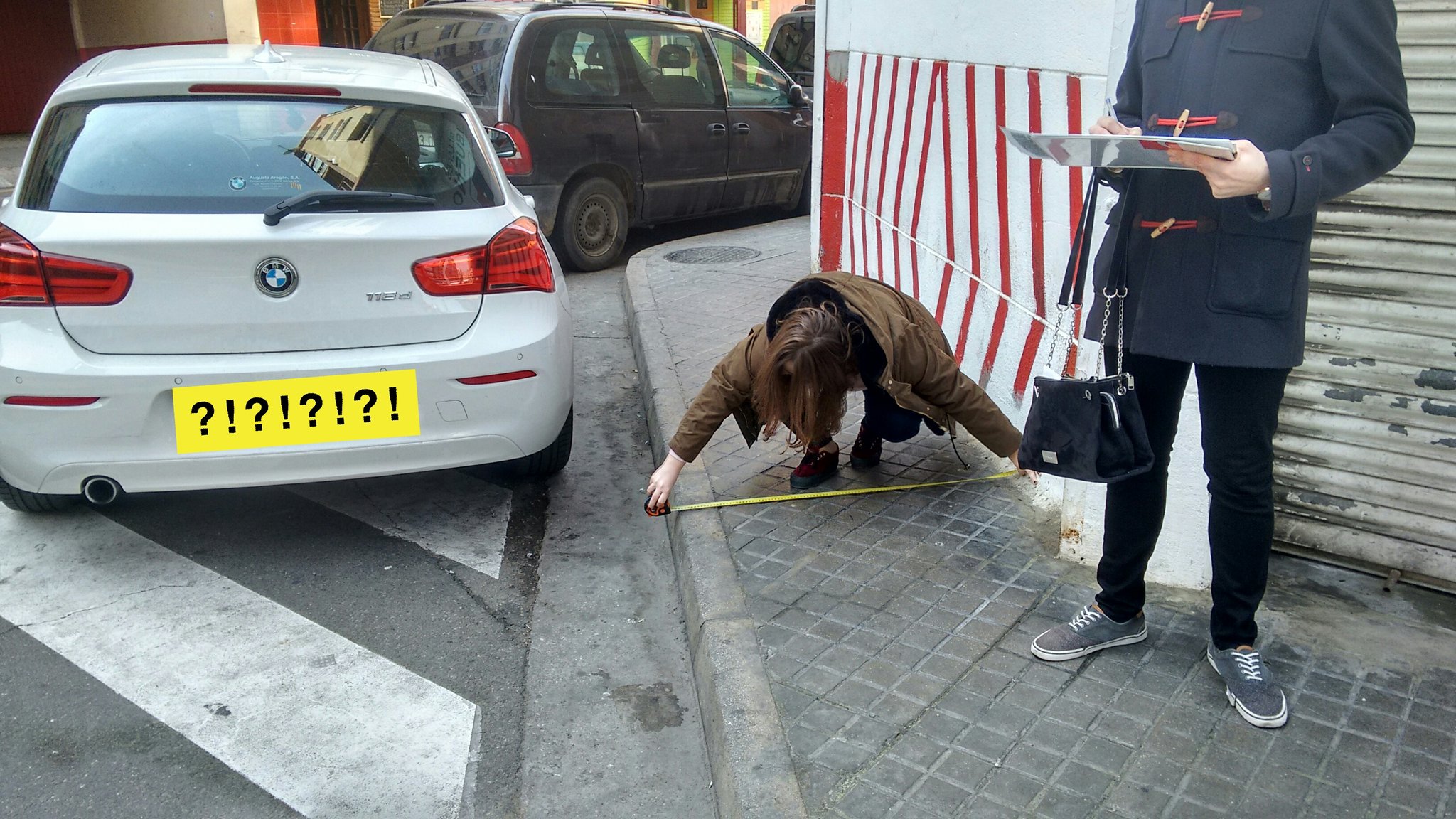
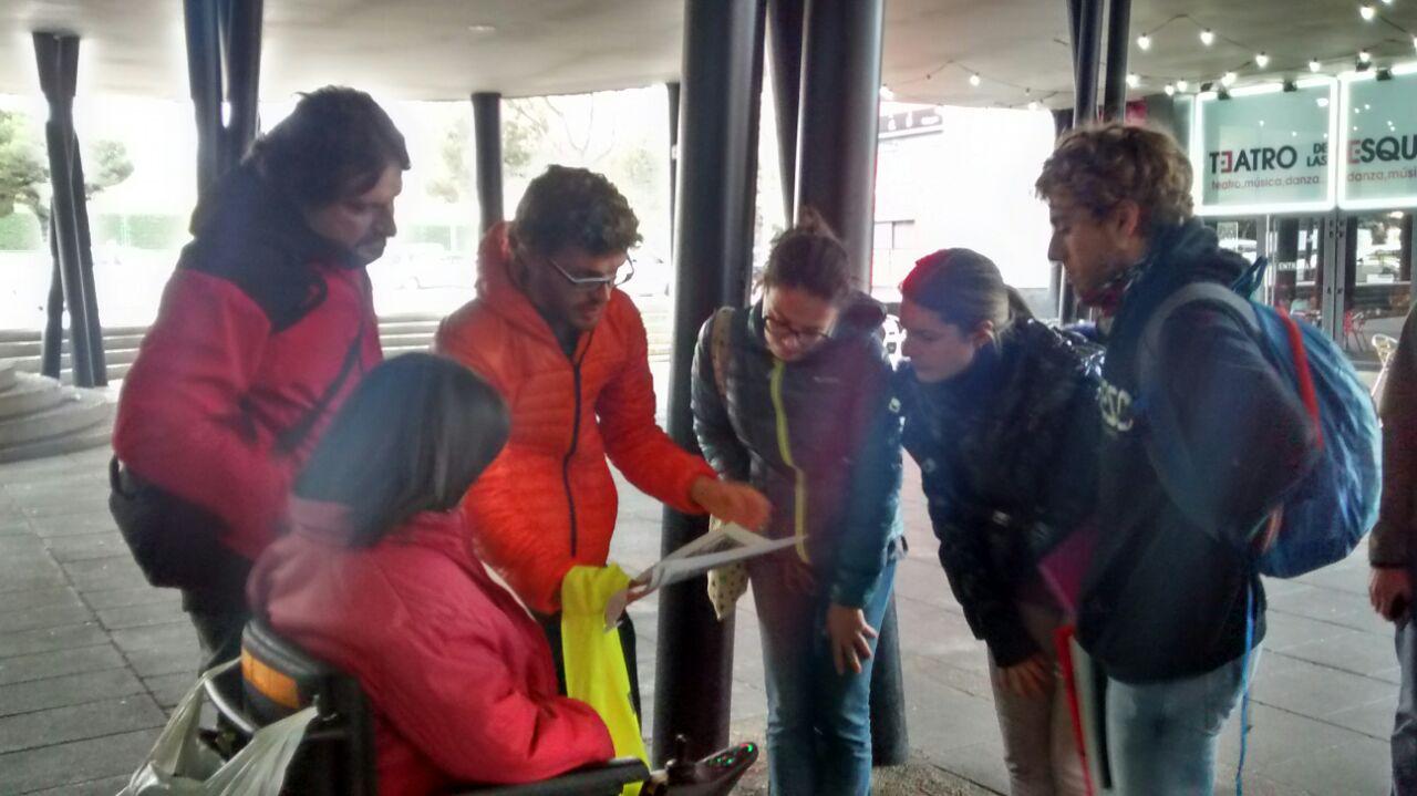
Data gathering methods
How is data gathered?
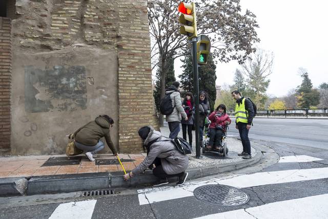
Mapping parties
- 6 Mapping parties (last one, this very morning)
- Volunteers doing field work in a coordinated way
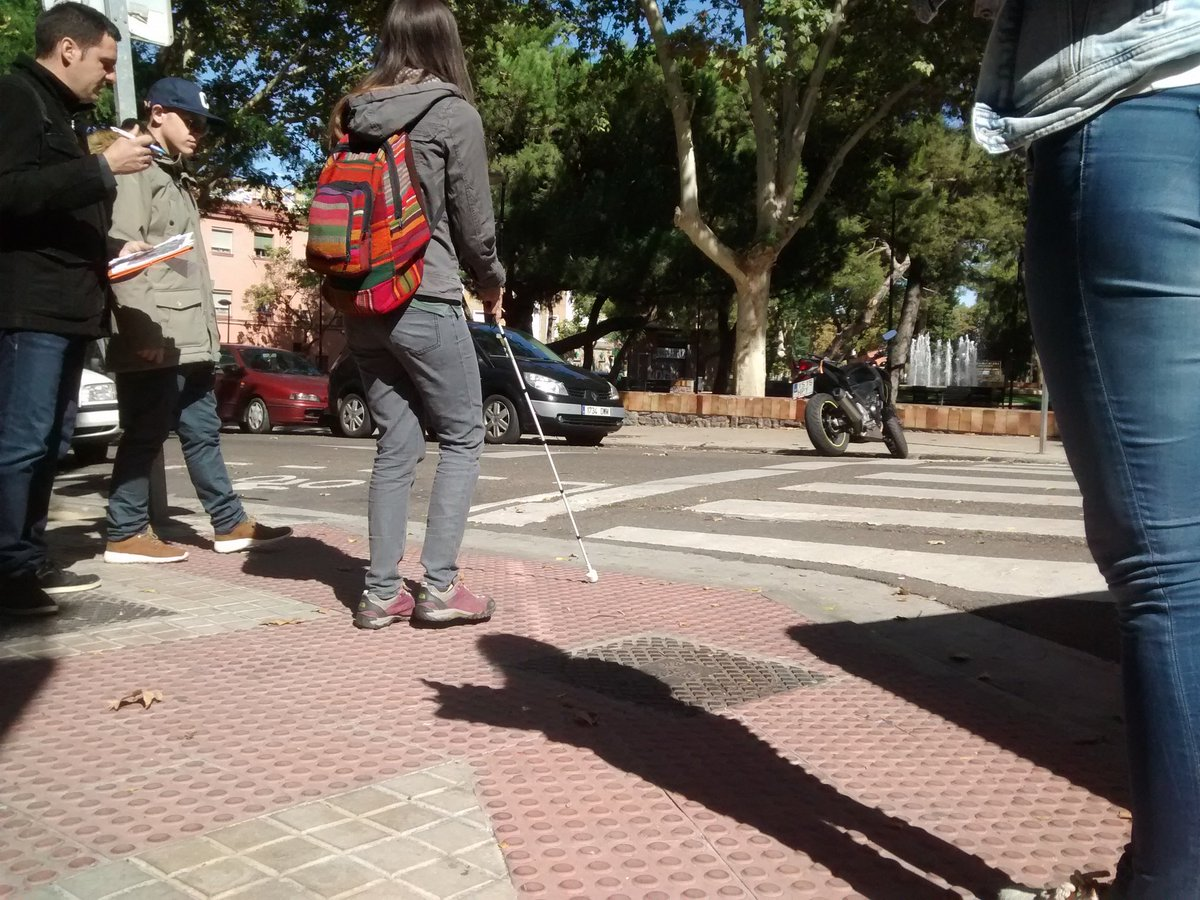
Service Learning Activities
- Compulsory for Urban Studies' students from Architecture Degree at Universidad San Jorge
- Aimed to future urban planners
- Compulsory paper
- Content:
- Social implications of urban design
- Digital Tools (GIS, consultas a BBDD…)
Fieldwork made by USJ’s researchers
Thanks to César Canalís (2016-17), Lourdes Pérez (2016-17) and Javier Claver (2018-2019)!
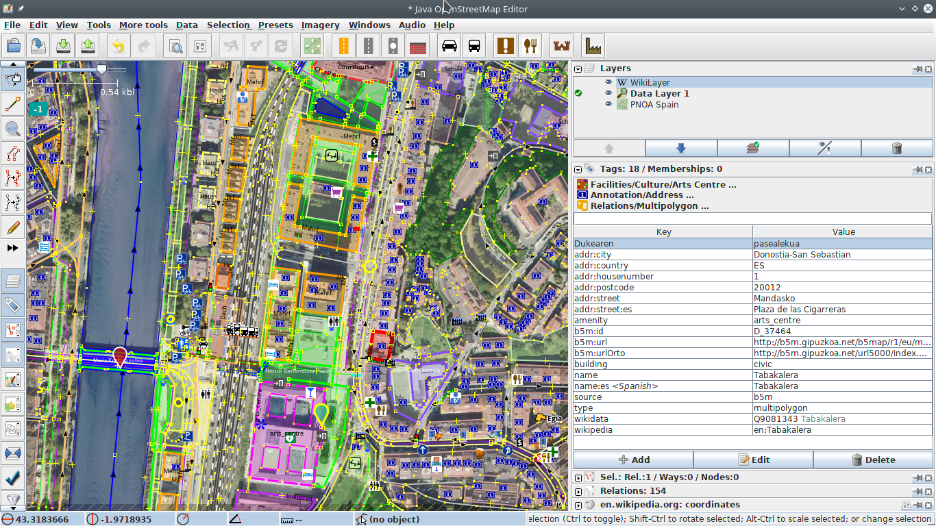
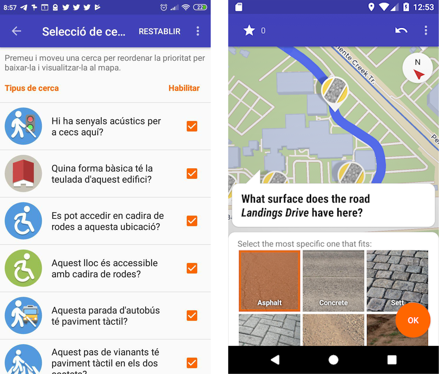
Data gathering tools
Mapillary (collaborative streetview images)
Publishing data
We upload data gathered to OSM
Results
Rise awareness
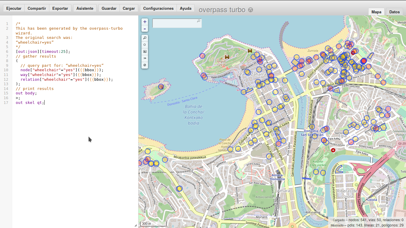
Visualization
2 online maps: visual and mobility impairment
Media appearance
(unexpected outcome)
Gràcies!
- To you, for your attention
- To Raons Públiques, for their invitation and coordination
- To Centre Cultural Albareda del Poble-sec, for hosing us
- To my colleagues from Mapeado Colaborativo
- To everyone who has participated in Accessible Zaragoza
- To Universidad San Jorge
- To Discapacitados Sin Fronteras, MundoCrip, AAVV, Centros Cívicos, Ganchillo Social…
- To OpenStreetMap Community

Esta obra está bajo una licencia de Creative Commons Reconocimiento-CompartirIgual 4.0 Internacional.
Questions?
https://mapcolabora.org | @mapcolabora
Esta obra está bajo una licencia de Creative Commons Reconocimiento-CompartirIgual 4.0 Internacional.